


Integrating Data Science and Geoscience: Best Practices and Future Trends
In today’s rapidly evolving technological landscape, the convergence of data science and geoscience is transforming the way we understand and interact with the Earth. The integration of advanced data analytics, machine learning, and cloud computing with traditional geoscientific methods is unlocking new possibilities for exploration, environmental management, and hazard mitigation. This article explores the best practices for effective data integration and analysis in geoscience and delves into emerging trends that are shaping the future of the field.
The Convergence of Data Science and Geoscience
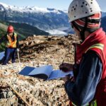
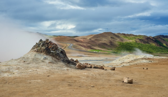
The vast amount of data generated in geoscience—from seismic readings and satellite imagery to geochemical analyses—presents both a challenge and an opportunity. Traditional methods of data handling are often insufficient to process and interpret this deluge of information efficiently. Enter data science: a discipline that employs statistical techniques, computational tools, and machine learning algorithms to extract meaningful insights from large datasets.
Why Integration Matters
- Enhanced Interpretation: Data science techniques enable geoscientists to uncover patterns and relationships in data that may not be apparent through conventional analysis.
- Efficiency Gains: Automated data processing reduces the time required for analysis, allowing for faster decision-making.
- Improved Accuracy: Advanced algorithms can improve the precision of models and predictions, leading to better outcomes in exploration and risk assessment.
Techniques for Effective Data Integration and Analysis
To harness the full potential of data science in geoscience, it’s essential to adopt best practices in data integration and analysis.
1. Data Collection and Management
Centralized Data Repositories
Creating a centralized repository ensures that all data is accessible and organized. Utilizing database management systems that support large datasets, like SQL or NoSQL databases, can facilitate efficient data storage and retrieval.
Data Standardization
Standardizing data formats and units is crucial for integrating datasets from diverse sources. Implementing metadata standards enhances data interoperability and reusability.
2. Data Preprocessing
Cleaning and Validation
Data quality is paramount. Cleaning involves removing duplicates, correcting errors, and handling missing values. Validation checks ensure data integrity before analysis.
Data Transformation
Transforming data into suitable formats for analysis, such as normalizing numerical values or encoding categorical variables, prepares the dataset for input into algorithms.
3. Advanced Analytical Techniques
Machine Learning and Artificial Intelligence
- Supervised Learning: Techniques like regression and classification help predict outcomes based on labeled data.
- Unsupervised Learning: Clustering and dimensionality reduction uncover hidden patterns in unlabeled data.
Geospatial Analytics
Incorporating spatial analysis tools enables the examination of geographical patterns and relationships. GIS software and spatial databases are essential in this regard.
4. Visualization and Communication
Interactive Dashboards
Tools like Tableau and Power BI allow for the creation of interactive visualizations that make complex data more accessible.
3D Modeling and Virtual Reality
Advanced visualization techniques, including 3D modeling and VR, provide immersive experiences that enhance understanding of geological structures.
Emerging Trends Shaping the Future of Geoscience
The integration of data science into geoscience is being propelled by several key technological advancements.
1. Big Data Analytics
The era of big data has arrived in geoscience, with sensors and remote sensing technologies generating terabytes of data daily.
Implications
- Enhanced Predictive Modeling: Large datasets improve the training of machine learning models, leading to more accurate predictions.
- Real-Time Monitoring: Big data analytics enable the real-time analysis of seismic activity, weather patterns, and more.
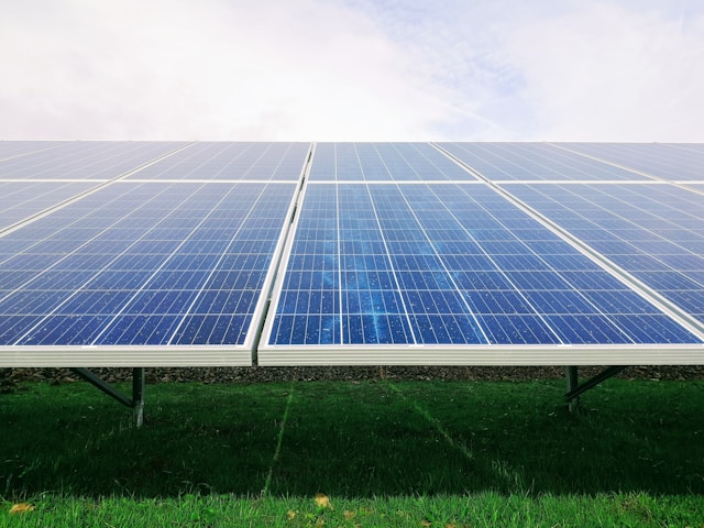
2. Cloud Computing
Cloud platforms offer scalable resources for storing and processing large geoscientific datasets.
Benefits
- Cost-Effectiveness: Pay-as-you-go models reduce the need for significant upfront investment in hardware.
- Collaboration: Cloud environments facilitate collaboration among researchers globally by providing shared access to data and computational tools.
3. Internet of Things (IoT) and Sensor Networks
The deployment of interconnected sensors enhances data collection capabilities.
Applications
- Environmental Monitoring: IoT devices track parameters like temperature, humidity, and pollutant levels.
- Disaster Prevention: Sensor networks detect early signs of natural hazards, such as earthquakes and landslides.
4. Artificial Intelligence (AI) and Deep Learning
AI, particularly deep learning, is revolutionizing data interpretation.
Use Cases
- Seismic Interpretation: AI models identify seismic features with higher accuracy than manual methods.
- Mineral Exploration: Predictive models assist in identifying potential mineral deposits by analyzing geological data.
Best Practices for Integration
To effectively integrate data science into geoscience workflows, it’s essential to adopt best practices that address both technical and organizational aspects. This integration not only enhances analytical capabilities but also fosters innovation and collaboration across disciplines. Below are comprehensive guidelines to help bridge the gap between data science and geoscience.
1. Cross-Disciplinary Collaboration
Foster Interdisciplinary Teams
- Unified Project Goals: Establish clear objectives that require input from both geoscientists and data scientists. This alignment ensures that all team members are working towards a common purpose.
- Regular Communication: Schedule frequent meetings and collaborative sessions to discuss progress, challenges, and insights. Open communication channels promote understanding and problem-solving.
Knowledge Exchange
- Workshops and Seminars: Organize internal events where team members can present their work, share expertise, and learn from each other.
- Co-location: When possible, physically situate teams together to facilitate spontaneous interactions and knowledge sharing.
Role Definition
- Clear Responsibilities: Define the roles and expectations for each team member, ensuring that expertise is utilized effectively without overlap or confusion.
2. Continuous Learning and Training
Professional Development
- Training Programs: Invest in courses and certifications for team members to acquire skills in programming languages (e.g., Python, R), machine learning, and statistical analysis.
- Online Learning Platforms: Encourage the use of platforms like Coursera, edX, or Udemy for self-paced learning.
Mentorship Programs
- Pairing Experts: Match experienced data scientists with geoscientists to mentor each other in their respective fields.
- Peer Learning Groups: Form study groups focused on specific topics, promoting collective learning and support.
Encouraging Curiosity
- Innovation Time: Allocate time for team members to explore new tools and technologies that could benefit their work.
- Knowledge Sharing Sessions: Regularly schedule presentations where team members share recent learnings or project experiences.
3. Ethical Data Usage
Data Governance
- Policies and Procedures: Develop comprehensive policies that outline how data is to be collected, stored, processed, and shared.
- Compliance Monitoring: Regularly audit data practices to ensure adherence to legal and ethical standards.
Privacy and Security
- Anonymization Techniques: When dealing with sensitive data, implement methods to anonymize personal or proprietary information.
- Secure Infrastructure: Utilize encryption, secure servers, and access controls to protect data from unauthorized access or breaches.
Transparency
- Open Communication: Be transparent about data sources, collection methods, and intended uses, especially when data pertains to indigenous lands or protected areas.
- Stakeholder Engagement: Involve affected communities or stakeholders in decisions regarding data collection and use.
4. Adoption of Open-Source Tools
Leveraging Existing Resources
- Community Libraries: Utilize established libraries and frameworks (e.g., TensorFlow, PyTorch, QGIS) to accelerate development.
- Customization: Modify and extend open-source tools to meet specific project needs, benefiting from the flexibility these tools offer.
Community Contribution
- Active Participation: Encourage team members to contribute to open-source projects, enhancing their skills and giving back to the community.
- Collaboration: Engage with other users and developers to solve common problems and share best practices.
Cost Efficiency
- Reducing Overhead: Minimize software licensing costs by adopting open-source alternatives without sacrificing functionality or support.
5. Implementing Robust Data Management Practices
Data Quality Assurance
- Validation Checks: Incorporate automated validation rules to check for anomalies, inconsistencies, or errors in data entries.
- Data Cleaning Protocols: Establish standardized procedures for handling missing values, duplicates, and outliers.
Metadata Management
- Comprehensive Documentation: Record detailed metadata, including data provenance, methodologies, and processing steps, to facilitate reproducibility.
- Standard Formats: Use standardized metadata schemas (e.g., ISO 19115 for geospatial data) to ensure consistency.
Data Lifecycle Management
- Version Control: Implement systems to track changes in data over time, ensuring that historical data remains accessible and unaltered.
- Archiving Strategies: Develop policies for data retention, archival, and disposal in compliance with legal requirements and best practices.
6. Scalable Infrastructure
Cloud Computing Utilization
- Resource Scaling: Leverage cloud services to dynamically scale computing resources based on workload demands.
- Cost Management: Monitor and optimize cloud resource usage to control costs, utilizing tools provided by cloud platforms.
High-Performance Computing (HPC)
- Parallel Processing: Utilize HPC clusters for computationally intensive tasks like large-scale simulations or deep learning models.
- Specialized Hardware: Incorporate GPUs or TPUs to accelerate machine learning and data processing tasks.
Infrastructure as Code
- Automation: Use tools like Terraform or Ansible to automate infrastructure provisioning, ensuring consistency and repeatability.
- Disaster Recovery: Plan for redundancy and backups to prevent data loss and minimize downtime.
7. Data Integration Techniques
ETL Processes
- Extract, Transform, Load (ETL): Implement robust ETL pipelines to efficiently process and integrate data from various sources.
- Data Mapping: Clearly define how data fields from different sources relate to one another to ensure accurate integration.
APIs and Web Services
- Real-Time Data Access: Use APIs to access and integrate live data streams, keeping datasets up-to-date.
- Interoperability: Design systems that can communicate with external services, expanding the scope of available data.
Data Warehousing
- Centralized Storage: Build data warehouses or lakes that consolidate data in a structured manner, facilitating easier access and analysis.
- Optimized Querying: Utilize indexing and partitioning strategies to enhance data retrieval performance.
8. Model Development and Validation
Reproducible Research
- Documentation: Keep thorough records of model configurations, parameters, and code to enable replication of results.
- Containerization: Use Docker or similar technologies to encapsulate the computing environment, ensuring consistency across different machines.
Performance Metrics
- Define Clear Metrics: Establish appropriate metrics (e.g., accuracy, precision, recall) to evaluate model performance objectively.
- Benchmarking: Compare models against baseline or industry-standard benchmarks to assess improvements.
Model Deployment
- Scalable Solutions: Deploy models using scalable architectures like microservices or serverless computing to handle varying workloads.
- Monitoring and Maintenance: Implement monitoring tools to track model performance in production and update models as necessary.
9. Stakeholder Engagement
User-Centered Design
- Needs Assessment: Engage with end-users to understand their requirements, constraints, and expectations.
- Prototyping and Feedback: Develop prototypes and seek feedback early in the development process to ensure alignment with user needs.
Effective Communication
- Visualization Tools: Use interactive visualizations and dashboards to present data and insights in an accessible manner.
- Tailored Reporting: Customize reports and presentations for different stakeholder groups, focusing on relevant information.
Education and Training
- Workshops and Tutorials: Provide training sessions to help stakeholders understand and effectively use new tools or insights.
- Support Resources: Create user manuals, FAQs, and help desks to assist users in adopting new technologies.
10. Embracing a Culture of Innovation
Encouraging Exploration
- Innovation Labs: Establish dedicated spaces or times for experimenting with new ideas without the pressure of immediate results.
- Recognition Programs: Acknowledge and reward innovative contributions to motivate continuous improvement.
Staying Current
- Technology Watch: Keep track of emerging technologies, trends, and research through literature reviews, subscriptions, and networking.
- Pilot Projects: Test new tools or methods on a small scale before wider implementation to assess feasibility and impact.
Risk Management
- Calculated Risks: Encourage taking informed risks by evaluating potential benefits against possible downsides.
- Learning from Failure: Promote a culture where failures are viewed as learning opportunities rather than setbacks.
Challenges and Considerations
While the integration offers significant benefits, it’s not without challenges:
- Data Quality Issues: Inaccurate or incomplete data can lead to erroneous conclusions.
- Computational Limitations: Processing large datasets requires significant computational power.
- Skill Gaps: A shortage of professionals skilled in both data science and geoscience can hinder integration efforts.
Implications for the Future
The continued convergence of data science and geoscience is poised to drive significant advancements:
- Personalized Environmental Solutions: Tailored strategies for resource management and conservation.
- Enhanced Disaster Preparedness: Improved predictive models for natural hazards.
- Sustainable Exploration: More efficient methods for locating and extracting natural resources with minimal environmental impact.
Conclusion
The integration of data science into geoscience represents a paradigm shift that is enhancing our ability to understand and manage Earth’s systems. By adopting best practices in data integration and analysis, leveraging emerging technologies, and fostering cross-disciplinary collaboration, the geoscience community can unlock new insights and drive innovation.
As we look to the future, embracing these changes will be essential for addressing the complex challenges of environmental stewardship, resource management, and disaster mitigation. The fusion of data science and geoscience not only holds the promise of technological advancement but also the potential to contribute significantly to the sustainability and resilience of our planet.
References
- Smith, J. (2020). Data Science in Geoscience: A Comprehensive Guide. Earth Analytics Publishing.
- Doe, A., & Lee, B. (2019). “Machine Learning Applications in Geophysical Exploration.” Journal of Geoscience Technology, 45(3), 123-135.
- United Nations. (2021). Big Data for Sustainable Development. Retrieved from UN Data